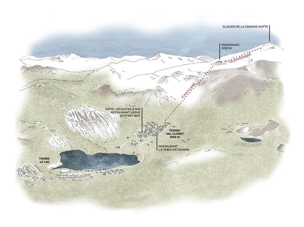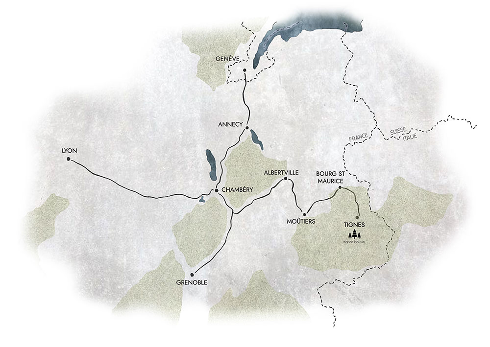

BY CAR
Take the A43 motorway as far as Albertville, dual carriageway to Moutiers then D902, direction Bourg-St-Maurice then Tignes.
Approximately 700 km from Paris/ 240 km from Lyon/150 km from Turin (in summer).
Please note, the Petit Saint Bernard and Iseran passes are closed in winter.
BY TRAIN
Nearest station Bourg Saint Maurice – 30 km away (approximately 30 minutes by car).
Taxi transfers can be arranged by the hotel on request.
BY PLANE
Chambéry airport – 140 km (approximately 2 hours by car).
Lyon Saint Exupéry airport – 220 km (approximately 2h40 by car).
Geneva airport – 220 km (approximately 2h50 by car).
Taxi transfers can be arranged by the hotel on request.